Brine pumping trials for the development of the Lake Throssell Sulphate of Potash (SOP) Project have demonstrated the abstraction potential of the lake surface aquifer, providing details to estimate an Indicated Mineral Resource.
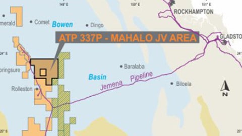
The trials are an important step in progressing Trigg Mining Limited’s Lake Throssell Project, located east of Laverton in Western Australia, following the completion of a highly successful lake trenching and test pumping program.
The program has been completed with the aim of estimating the aquifer properties, including drainable porosity (specific yield) and hydraulic conductivity, for the upper section of the lake surface aquifer.
This aquifer would be the target for initial production from a trench network. The trenching program has covered the surficial aquifer extent within the core tenement E38/3065.
Trigg Mining Managing Director, Keren Paterson, said, “This is another significant and encouraging milestone that provides further evidence that we have a very large and potentially company-making asset at Lake Throssell. The lake trenching and test pumping program has delivered highly encouraging results, providing invaluable data on the key characteristics of the surficial aquifer.
“Work is now underway on a maiden Indicated Resource, which represents a critical input to our ongoing Scoping Study work.”
The program consisted of two trial trenches and seven test pits distributed across the current resource. The trenches were 100m long and were surrounded on all sides by a number of monitoring pits.
The trial trenches were pumped until water levels in the majority of monitoring pits had stabilised, which was between ten and eleven days in both cases. Test pits consisted of a small pumping trench between 6m and 9m long with an adjacent monitoring pit. Test pits were dewatered and the brine level drawdown and recovery rates were monitored.
Throughout all testing, brine levels, flow rate and brine quality were frequently monitored. Trenching was completed with a 15-tonne amphibious excavator that was able to excavate between depths of 3m and 4.5m.
An example of the 100m-long trial trench and monitoring pit network is shown in Figure 1. A test pit excavation is shown in Figure 2, with layering evident close to the surface and becoming more clayey with depth.

Figure 1: Trial Trench 1 with surrounding monitor pits
The geology observed in the excavations was consistent with that previously logged during the resource drilling programs targeting the lake surface.
The lake surface to 2m below the ground level is more heavily dominated by gypsum, with clayey horizons dominant to the base of the excavation, intermixed with silty zones. The large excavation provided an opportunity to see the layered nature of the system, the brine inflow horizons associated with gypsum dominated layers, and the geotechnical stability of the walls.
The test pumping data has been analysed using local scale numerical models in groundwater modelling software FEFLOW. The models were calibrated to the brine level drawdown and recovery by changing the hydraulic conductivity (horizontal and vertical) and specific yield of the aquifer to obtain an acceptable fit between the measured data and the simulation.
The final aquifer property results are highly variable, confirming the highly heterogenous nature of the lake surface aquifer. Specific yield results varied between 0.01 (stiff clay) and 0.4 (the maximum possible related to gypsum evaporite sequences).

Figure 2: Test pumping of a Test Pit Excavation
Horizontal hydraulic conductivity ranged between 0.2m/d (stiff clay) and 340m/d (gypsum dominated flow). These results will be used to upgrade the lake surface brine resource and inform the Scoping Study of potential trench production rates, following further modelling.
Brine samples were obtained at the start and end of pumping of the test pits, while the trial trenches were sampled every day for field parameters of salinity, SG and pH, with samples retained for laboratory analysis on every second day.
The brine analysis results range between 4,610mg/L potassium (10.28kg/m3 of equivalent SOP) and 6,070mg/L potassium (13.54kg/m3 of equivalent SOP). These results align well with the Inferred Resource grade of the lake surface of 4,867mg/L potassium (10.85kg/m3 of equivalent SOP).
Brine grade variations during pumping show a muted varied response with most test pits moderately reducing in grade by less than three per cent, while the grade increased by up to ten per cent at one trial trench.
Following the completion of the on-lake trenching program, updated Mineral Resource modelling and Mineral Resource estimation work has commenced to calculate a JORC Indicated Mineral Resource Estimate for the surficial aquifer, which is expected to be completed before the end of this quarter.
This program will also allow preliminary sizing of the trench network required to support the Scoping Study SOP production during initial years of the project.


